Thursday, August 29, 2013

Day 55: Goddard Shelter to Congdon Shelter

Today's Miles: 14.4
Total Miles: 582.5

Today was slow moving and all kind of passed in a blur. The rain had stopped in the early morning, but it was still an overcast day. I descended Glastenbury Mountain, ready to leave this area. I stopped at Porcupine Ridge for an early lunch, where the clouds moved out of the way some for a peek at a view. I made it to Melville Nauheim Shelter, where I decided to take a break a little bit further down the trail, but was very unimpressed with the shelter. It was trashed, and there was a lot of unnecessary stuff left around - hot chocolate, toiletries, dishware, etc. I'm guessing the Long Trail hikers are learning what they don't need and are trying to get rid of it. Unfortunately, shelters are not the place to leave it all. 

I descended into the notch towards Bennington just in time for the clouds to burn off. This left me with sun and almost 80% humidity. It was pretty miserable from that point, especially with the climb I knew I faced. I had to make my way back out of the notch, and it was a pretty tough climb for Vermont. It was very steep and rocky, but I was glad I was climbing up instead of down, especially since most of the rocks were still wet and slick. As I continued on, I started to feel terrible. To add to the fun, I started to see the Vermont I was warned about - MUD. At this point my throat was sore and I had no energy. I was struggling with each step. I was glad to see the shelter, and I quickly set up camp. I made some soup for dinner, and I hope to feel better in the morning. Maybe it's just because of the temperamental weather. I'll be going into town tomorrow, so I can always stay there if necessary. 

Porcupine Ridge

Harmon Hill


Ver-mud!

Day 54: Stratton Mountain to Goddard Shelter

Today's Miles: 16.3
Total Miles: 568.1

The wind was howling through the trees when I woke up, but thankfully the rain had already passed. It had started to rain when I woke up around 11:00 to go to the bathroom last night, which was much earlier than expected. I stayed in my sleeping bag for a while, just knowing it would be chilly outside of my tent. I finally finished getting everything together around 8:00 and headed out into the overcast day. I admired the trail work on the way down Stratton Mountain, thankful to Hugh and Jeanne for the hard work they put in to make it so great. 

When I came to the first road crossing, I found Mark waiting for Graham and Laura. I said a quick hello before moving on. I hope they are both doing well. I continued on to where the trail crossed a forest road and talked to a guy who was out doing the Long Trail. He had started 2 days prior and seemed to be doing well for the most part. Hopefully his hike is successful. It's weird seeing people out for a long distance hike but starting off fresh. It doesn't feel like it was that long ago I had a new pack, clean shoes, and hadn't adjusted to the trail stink yet. Oh, how things have changed! 

There was a 7 or 8 mile stretch of trail today that I didn't pass another hiker. It was overcast, foggy, and pretty dreary so I was hoping for some type of conversation to pass the time. I had also heard about Glastenbury Mountain, my next climb, being haunted, so I was mentally psyching myself out a little bit. Add that to what Jeanne and Hugh had told me about the mysterious cairns at the top that were suspected to have been there for hundreds of years (Native American construction?) and I was ready to call it a day. I stopped at Kid Gore Shelter, which had a nice view, and tried to decide if I would be able to beat the rain. I decided to move on since it was still too early. Just before I made it to the top of the mountain, it started to rain. Of course. I decided to still climb the fire tower but was being pelted by rain and couldn't see a thing. I made my way down, hoping to be able to find the cairns. I was unsuccessful because I couldn't see much with all the fog. It was all pretty eerie up on the mountain top too. I hiked the short remaining distance to the shelter, where there would be some respite from the rain. It's a nice shelter, not too old and with a little porch on the front. There's a mix of NOBOs and LT hikers here tonight. I made dinner, but the LT hikers had brought out fresh veggies and were cooking up quite a feast. They had leftover lentils and offered some up to us. I happily accepted. A hiker never turns down a food offer! The rain has started to fall harder as the night goes on. Hopefully the mountain doesn't live up the myths about it tonight. I would be happy with an uneventful night here. 

I got this picture today of my second love. How does a face like this not make your day?!


Kid Gore Shelter

The view on Glastenbury...outstanding. 

Day 53: Manchester Center to Stratton Mountain

Today's Miles: 13.7
Total Miles: 551.8

Today was a perfect example of something not going as planned but still having a perfect ending. I left the Green Mountain House a little late since no one else wanted to leave early, and the other guy who was supposed to be leaving was running late. Lack of punctuality is still one thing I have a huge problem with, especially when it affects other people. It was 9:00 before I was on the trail, and I was planning on doing 21 miles today. I knew that with a start that late, there would be some night hiking involved. 

The day started with a small ascent, but the elevation profile seemed to be pretty flat for the majority of the day. I guess that was just relative to Stratton Mountain because there still seemed to be a constant up or down throughout the day. I was going to stop at Spruce Peak Shelter for a snack a few miles in, but it was a little off the trail. I just picked a rock to sit on and took a break there. I was in that weird "getting out of town" funk, so I called home and talked to Payce for a little while. It usually helps give me a little bit of motivation to start back up again. As I prepared to walk along a gravel road, I saw a sign for Prospect Rock. I decided to take the short side trail leading out to a valley overlook. I took my pack off and sat on the rock for a few moments, enjoying the view. I had to continue on the road for a little while, but I was happy to find it lined with blackberries. This is always a nice surprise! Shortly after I left the road and entered back into the woods, I passed the 1/4 point on the trail - 546 miles! It feels great to have made it to this point. 

A few more miles found me at Stratton Pond. It was a great location, and I was very tempted to stay for the night. I wanted to at least make it over Stratton Mountain, however, since tomorrow is calling for rain. I continued on and started the climb up the mountain. The ascents in Vermont are so much different than Maine and New Hampshire because they don't present a challenging climb directly in front of you. They are gradual, and you can never actually see the top of the mountain from where you are. There are trees all around, but you can still see the sky peeping through the leaves so it's impossible to see the summit. The climb can be 2 or 3 miles, but they are actually quite enjoyable miles. 

I was happy to see the fire tower at the top since it was already 5:00, and I was still planning on 7.5 miles. I climbed up to the fire tower and was able to see mountains all around. This is where Benton MacKaye visualized the Appalachian Trail, where the dream of a trail from Maine to Georgia came into fruition. I was so glad I could see it before it would be swallowed by clouds tomorrow. This was too much of an important moment to miss. After I made my way down the fire tower and continued to the trail, I passed the caretakers' cabin. They started up a conversation, and as I prepared to push on they invited me to dinner. I knew it was late, but I couldn't resist such a generous offer. I shook off my pack and made my way inside. The two caretakers, Hugh and Jeanne, were inside, as well as a guy named Adam who worked at the nearby resort. We sat and talked while Jeanne finished up dinner and then enjoyed a delicious meal that I would have never expected on top of a mountain. They were great people, and Hugh had been up there since 1968. He and Jeanne stay up there during the summer and early fall, and they seem to genuinely love what they do. They also maintain 8 miles of the trail in the area. They offered a lot of great history of the area, and I was fascinated. It was getting late as I prepared to continue on. Adam offered a ride to the nearest road crossing since it would only be a short walk to the resort from the summit, but I would have felt guilty skipping the miles. Hugh and I went up the tower to catch the sunset, which we could see trying to break its way through the clouds that were already forming. He pointed out the more prominent mountains, including Mount Monadnock in New Hampshire, a mountain I've climbed before. I continued a short way down to a stealth camp after having tea. It was dark when I climbed into my tent, and I was secretly relieved I didn't have to night hike. 

I am so thankful to Jeanne and Hugh, and it was great to meet Adam as well. They illustrate that trail magic can come in many forms, when you least expect it, but always at the time when you need it most. 

I guess moving the Prospect Rock sign down would have been too much work, so they just put a sign saying "Look up."

Prospect Rock

Stratton Pond


Fire Tower on Stratton Mountain


Sunset

Saturday, August 24, 2013

Day 52: Peru Peak Shelter to Manchester Center

Today's Miles: 10.1
Total Miles: 538.1

This morning was another rare morning I was forced to set an alarm. I had to make it into town by noon so I could pick up my mail drop. I was up a little after 5:00 but tried to keep my sleeping bag out until the last minute. I'm guessing it was no warmer than the low 40s this morning. I struggled to get motivated, but finally got on the trail around 6:30. I raced uphill to Peru Peak and Styles Peak. There wasn't much of a view, so I wasn't too tempted to stop. The mountains of today's hike made the time constraint more pressing. I knew the first two climbs would be easy. It was Bromley Mountain I was afraid of. I stopped in Mad Tom Notch for a quick snack and filled up on water at the hand pump. At least I was able to get an upper body workout today. It took at least 20 pumps before the water started flowing, but it was cold and clear when it finally made its way out. I started my quick ascent of Bromley after. Most of the climb was gradual and easy to breeze through. The elevation profile looked like it was going to be really steep at the top, but it wasn't bad at all. There was a lodge and a ski lift at the top, as well as some incredible views. I stopped for a few minutes to talk to a pair of SOBOs I hadn't met yet. They were the first ones I've seen in days. I tightened up my shoes in preparation for the descent and continued on, knowing that the race was on. I danced around rocks and roots and raced across bog bridges. I passed a seemingly wonderful lady who I normally would have stopped and had a long conversation with, but we had to cut it short since it was already 10:30. I made it to the trailhead by 11:00, but now came the hard part - getting into town. 

I tried to call the taxi service in town, but they said they were too busy to pick me up. It was 5 miles away, so I knew I would have to hitch. I nervously waited by the roadside with my thumb out, but all the cars kept passing by. I thought I would never get into town. Finally, a woman in a little red car on her way to work pulled over. I breathed a sigh of relief, ran over, and crammed myself in. She brought me to the top of the road the post office was on, and I walked the rest of the way there. I made it with plenty of time and was finally able to get my mail drop and repack all the food in it. I headed back to the main road, and the next thing I knew, I was walking to Shaw's supermarket a mile and a half away. I used to work at a Shaw's and have a very hard time resisting their cookies. There was another store less than half that distance, but at that point what's another mile and a half? I made sure to buy fruit, one of the first trail town priorities, and the cookies, of course. I called up Jeff at the Green Mountain House so I could be picked up. This place was the only reason I planned on staying in town. I had heard such wonderful things about it, so I made sure to make a reservation a few days in advance since it can fill up very quickly. He pulled up, surprised that I had ended up at Shaw's since most hikers don't get that far. We headed back to the hostel where I was given the tour and rules of the house. It is incredibly clean and very well run (and a pint of Ben & Jerry's is included with the stay). I'm the only SOBO here, but there are 7 other NOBOs. I wish I could stay here longer, but it'll be back to the trail tomorrow.

I do have to say that this is the first day I've actually felt myself getting stronger. When I started, there was absolutely no way I would have been able to climb 2 mountains above 3000 feet and finish 10 miles in 4 hours. It feels pretty good right now that I can say that. 

Mad Tom Notch water pump

Bromley Mountain


Old shoes at the Green Mountain House 

Day 51: Greenwall Shelter to Peru Peak Shelter

Today's Miles: 14.5
Total Miles: 528.0

Forcing myself to put on cold and wet clothes on a still-chilly morning may be one of the worst experiences out here. I shivered my way into them and headed out into the foggy morning. There's always something so quiet, so peaceful about hiking early before all the fog has burned off for the day. The colors are so vibrant in contrast to the gray all around. I love hiking alone when it is so quiet I can hear a leaf fall from a tree to the forest floor. The rain had stopped, but I felt like the trees were laughing at me with every gust of wind that would cause them to shake their rain-soaked leaves onto me and the trail below. I feel like fall is hot on my tail as the mornings are getting colder and the days are getting shorter. More and more leaves can be found littering the ground, and I look forward to being able to witness the leaves changing colors as the season progresses. 

The start of the day soon found me in a cairn garden, surrounded by stacks of rocks that were bearing an eerie resemblance to tombstones in a fog-covered world. I took my first break at the Little Rock Pond, where I sat and watched a loon swimming around while I enjoyed a snack. There were 5 shelters today in a 10 mile stretch, and most of them were at very enjoyable locations. It became very hard for me to resist stopping at each one. I stopped for lunch at Big Branch Shelter down by the water. There were so many places to sit on the rocks and soak up the sun, so I made sure to enjoy every minute of it, drying out my socks and shoes that were still wet from last night. I had a gradual climb up to Baker Peak, where I was met with some great views. Most of the remaining hike was flat to Peru Peak Shelter and followed around Griffith Lake for a short distance. I wasn't sure if I would be able to continue on since the next shelter was 8 miles away, so I decided to stay at Peru Peak. It was a quiet location sitting right beside a stream. It reminded me of a lot of shelter locations in Maine. There are 2 other NOBOs here tonight. I'm hoping to start off early tomorrow so I can make it into town before the post office closes. It will certainly be a close call. 

Cairn garden

More cairns

Balance

Little Rock Pond

The view from Baker Peak 


Day 50: Cooper Lodge Shelter to Greenwall Shelter

Today's Miles: 18.9
Total Miles: 513.5

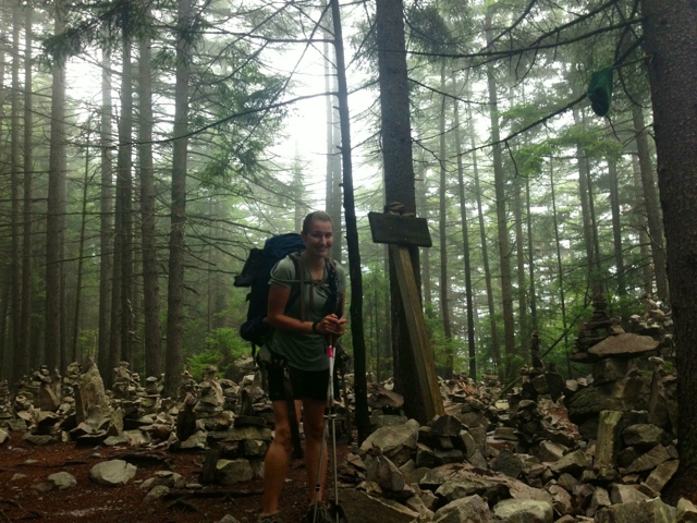
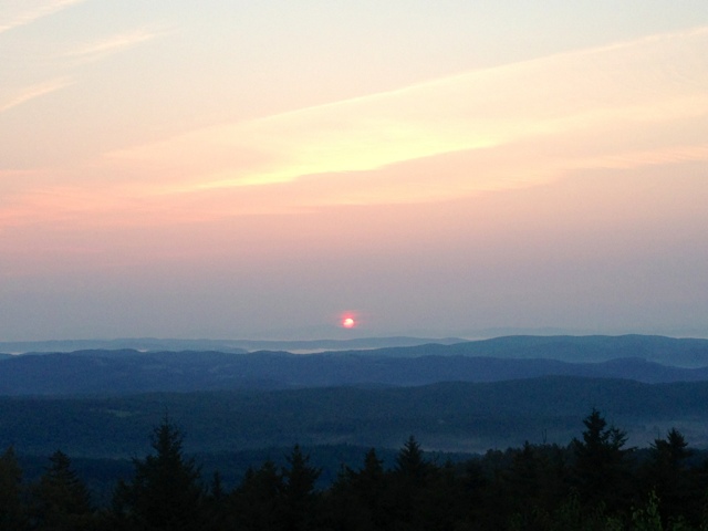
It's great to wake up to a warmer morning than what was expected. It was really chilly last night, and since the shelter's windows were all open I thought it'd be a little cooler at almost 4000 feet. I started getting ready, and when the group of new backpackers woke up they were happy to realize they had survived their first night in the woods. I headed out around 7:00, which seems to be making itself my approximate starting time each day. 

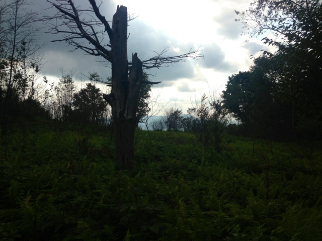
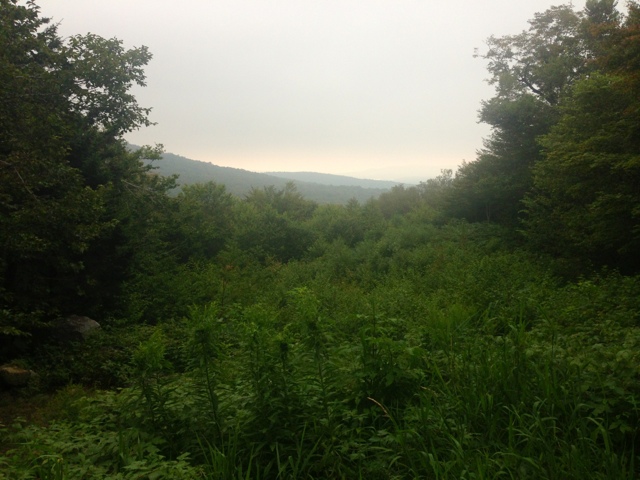
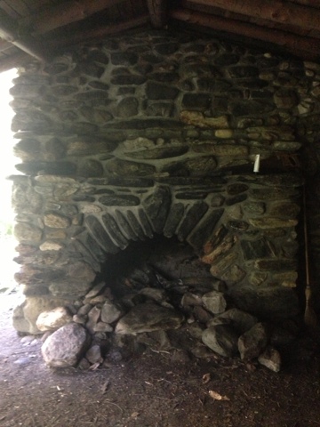
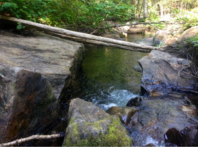
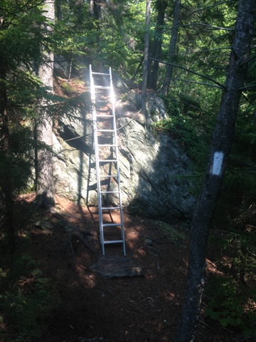
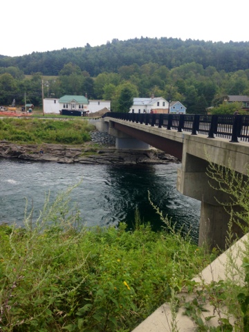
The day started with a descent which proved to be a little bit rocky. It was pretty gradual, so it wasn't too bad. When I reached the first shelter I decided to stop in for a snack break. Taped to the inside of the shelter register was a picture of 2 hikers in front of the Governor Clement shelter. The picture wasn't dated, but there wasn't a single tree to be found. Now the area is surrounded by trees. I thought it was really neat to see what a difference it is. There was a part of the trail just ahead that had signs for a detour around the brook whose bridge was washed out in Hurricane Irene. I was told by several NOBOs that it was still rock hoppable, so I decided to try my luck. It was a pretty easy crossing, and I was glad I decided to go that way, especially because I was able to see the 500 mile marker! It feels a little unreal, honestly. The damage from the storm was very evident further downstream. There were a lot of downed trees all along the banks, and at one point there was a giant pile of dead trees and wood from the bridge blocking the way. There was another brook shortly after that had two very awkwardly placed logs that I'm assuming were in place to assist with crossing. I decided to move a little downstream and hop some rocks there instead since I'm pretty sure any attempt to use the logs would have been disastrous. 

I passed a road crossing a few more miles up where there was a man on a bike and a woman asking if I was SOBO and if I knew anything about the detour. I would later learn that their names were Laura and Graham. I was a little confused by the situation at first, not really sure why a bicyclist would be asking me that, so I was probably a little bit colder than I needed to be. I'm just a little wary of road crossings anyway, so I hope it was understandable. It turned out to be a couple from the UK, and the female was going to be hiking to the next road crossing. She asked if I would mind hiking together, and I gladly agreed to the company. She and her husband were SOBOs, but her husband was injured so they chose to do road walks together where they could so he could pedal along. They were slackpacking most of it and had an RV meeting them after certain sections. We hiked the next 4 miles together, and she invited me to lunch with them. I happily accepted since I told myself I could go to the restaurant a half mile down the road if I was there by lunch. They saved me an extra mile of walking, and I got to enjoy their company while there. It was interesting to see how they learned about the AT. They had allotted themselves 4 months to complete it. They had done various other backpacking trips in Europe before starting this one. Laura said that walking is an accepted part of life in the UK, which I think is so different than the states. She did say that the hikers out here take it very seriously, which is not so much the case there. It's much more casual. 

Lunch was incredible. I was able to enjoy a great salad, a hard boiled egg, fruit salad, and ice cream. All of this combined with their company made the best lunch experience so far. It really was trail magic! I'm so grateful they invited me to lunch, and I hope to see them more along the trail. They gave me a Coke for later along the trail, which has really become my addiction out here. Caffeine has helped me get through some tougher miles I might not have made it through otherwise. 

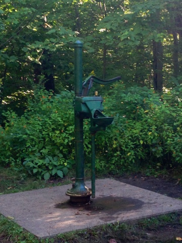
When we said our goodbyes, I headed down to the river for water. I was hesitant to fill up here since it was a heavily used area, the water was warm, and it had a funny smell to it. I didn't have much of an option since this was the last water for about 3 miles and I was completely dry. I took a break soaking my feet in the water and calling home. I then continued on for a few miles to the Minerva Hinchey shelter, where I stopped for a snack and replaced the river water I had collected. I had managed to make it the entire way without having to drink any of it, so I was a little relieved and drank down the cold, clean spring water happily. I had a climb up Bear Mountain and ran into a campsite with a group of NOBOs on the way down. The site belonged to Limpin' Eagle, who was away at the moment, but had left soda and hotdogs for passing hikers. I stopped, but quickly regretted it. The hikers were talking about how many chances I'll have to "party" in the south. It was incredibly annoying, especially considering the fact that I'm out here to hike, not party. They were also very critical of my plans to finish when I hope to, which I found a little out of line too. I left quickly, ready to distance myself from the negativity. I only had a mile and a half left to hike to the shelter, but it was all uphill. It started to rain with about 30 minutes left of hiking. I tried moving as quickly as possible, but it was pouring and I was drenched. I was happy to reach the shelter and find there was still room inside. There is one other person here, a guy out hiking the Long Trail named Morrison. He had arrived pretty early, trying to beat the rain in. He succeeded. I obviously did not. I was at least able to brush it off since the bad parts of the day were far outshined by the positive things that happened today. At least I am dry now with a roof over my head and a warm sleeping bag to cuddle up in. 

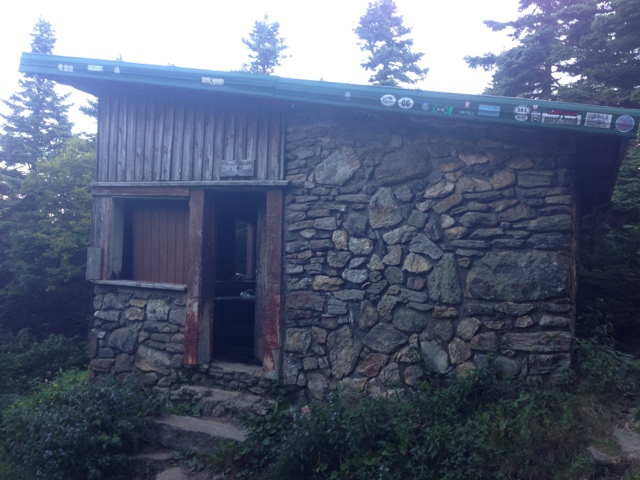
Governor Clement Shelter. The second oldest shelter on the trail. 

Stone fireplace inside the shelter

500 Miles!

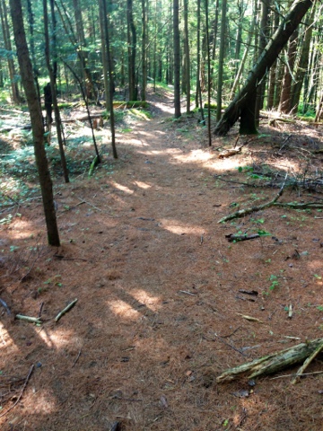
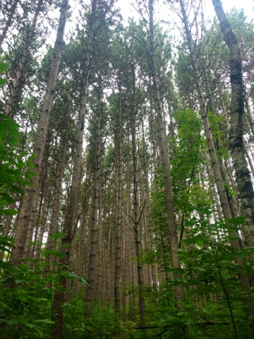
Oh, sweet pine needles, how you make my day!

Awkward brook crossing


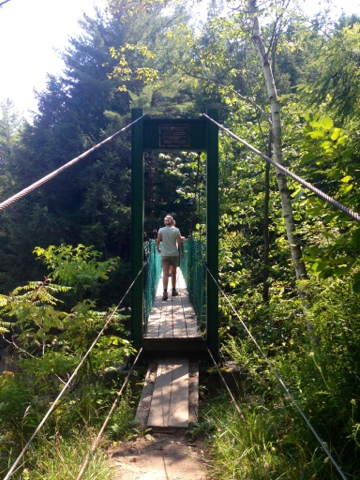
Suspension bridge over the river

Tree gateway


Day 49: Sherburne Pass to Cooper Lodge Shelter

Today's Miles: 8.2
Total Miles: 494.6

Breakfast was included with my stay at the Inn, so of course I made sure I was down there just after they opened. I got a delicious plate of French toast, and it was nice to have something other than pancakes for once. After eating, I headed back upstairs to gather some things to mail home. I had to walk to the post office, which was at least a mile down the road on Route 4. I stopped at the gas station and picked up something to drink, which was just a little further down the road. I then had the rest of the dreaded walk back, which was all uphill this time. I made it back with 45 minutes until checkout, so I packed everything up quickly and took one last quick shower. I checked out of the inn, but stayed around for a little while so I could eat lunch and avoid the hot afternoon hiking. I ate in the pub with some NOBOs who couldn't decide what they wanted to do for the day. I sat outside enjoying the sun for a little while before heading back to the trail, and they were still out there trying to determine their plans. 

The hike today was really quite boring. I climbed up to Killington Mountain, which was actually a pretty gradual and easy climb. I passed the trail junction where the Long Trail and the AT split. I will be following along the Long Trail for the next 100 miles through Vermont, as well as the AT. The LT continues on North through Vermont an additional 170 miles. I reached the Cooper Lodge Shelter early, even despite my late start. There was a large group camping there, so I decided to just stay in the shelter. It allows me to get an earlier start in the morning anyway. There was one other NOBO staying here, and a group of 3 came in a little later. They were out for a few days, and this was their first time backpacking. It was pretty evident when they were asking one another if the water they got from the brook tasted funny. We were able to give them a little advice, and I hope they're able to enjoy the trip. It's kind of a big section they're trying to complete, especially for their first time out. I wish them well, and I hope they stick with it!

The game room at the inn. It had all of these really neat old games in it. 

A sticker on the pub wall 

The first 4-walled shelter I stayed in. I think it barely classifies as that though, since there weren't any window coverings. Still pretty neat!

Tuesday, August 20, 2013

Day 48: The Lookout Cabin to Sherburne Pass, Killington

Today's Miles: 15.4
Total Miles: 486.4

As I laid there in the cabin last night, I was awoken by the luminescence of the full moon streaming through the window. It would have been a great night for hiking had it called for it - perfectly clear and incredibly bright. I kept waking periodically, afraid I would miss the sunrise. I had to keep checking my watch because it was too light outside to tell what time it really was. I had a dream that I missed the sunrise, which finally stirred me from my slumber. I headed straight to the roof, which wasn't the best idea. It's difficult to climb a ladder when my feet haven't woken up yet. I made it just minutes before the bright pink orb started to make its appearance over a distant mountain. There was only one other person that made it up for it, and I was a little saddened all the other hikers didn't get to experience it. It was really incredible, and I was glad I was there to witness it. I stayed up top for about half an hour before heading back down and gathering my things. 

I was too distracted by the vast amount of spiderwebs I was charged with clearing with my face and arms across the trail to really pay much attention to the trail itself. There were a few hills, but nothing too difficult. I was thankful to see the first NOBO on the trail, which I later discovered was Whirled Peas, someone that Hobo said I would be coming across today. Her husband is in the military too, so we talked for a few minutes before continuing on. I've met a lot of great NOBOs, and it's unfortunate that I won't see them again along the trail. 

It didn't take long for the little ninja spiders to reconstruct their webs across the trail, and I soon found myself walking into a few more. Sometimes it is just a never ending battle. I stopped at the Stony Brook Shelter for lunch after filling on water since it wasn't far off the trail. I had a climb to Quimby Mountain after, which turned out to be terrible - not the trail condition, just my condition I suppose. It had warmed up a great deal since I had stopped for lunch. It was only expected to be 85 degrees, but this is a pretty significant change from the 60 degree weather I experienced in New Hampshire. I also ate cheese and crackers for lunch. Cheese plus hot weather plus hiking up a mountain equals a bad idea! I was chugging down water like crazy and quickly realized I was almost out. When I reached the top, I just sat for a minute and waited for everything to cool down. I asked a NOBO if there was water ahead because the book didn't list any until town. She said there would be some, and I was relieved. She had faced a similar situation coming up the other side. I continued on and came across some leftover trail magic by the River Road crossing. Someone had left some honeybuns and oatmeal creme pies. I helped myself to a honeybun before crossing and started talking to a section hiker slackpacking for the day named Nana. She and her husband have been section hiking for 13 years. We talked for a few minutes before I continued on. She was waiting at the road for her husband to pick her up. I reached the Thundering Falls area and was able to navigate my way down to a point where I could fill my water. It was a little tricky and slippery, but it was really my only option for the next 4 miles or so. The majority of the remainder of the hike to town was easy terrain. It was a small gradual uphill, but it followed around Kent Pond and into Gifford Woods State Park. There was a part of the trail that was an amazing blanket of fallen pine needles, nary a rock or root in site. It was a beautiful site, and my feet couldn't have been any happier at that moment. It was short lived however, as the last remaining mile or so was a steep uphill climb. I made it to where the trail split for Sherburne Pass and breathed a sigh of relief. I had to take this half mile side trail to the Inn, and I would be done for the day. Too bad the pass was terrible! It was so rocky, downhill, and a terrible way to end the day. I couldn't wait to be at the bottom. I finally made it to the Inn at Long Trail, got into my room, and took the longest shower. I went to the pub downstairs for dinner, where the server presented me with the "hiker menu." It listed all these delicious options - ramen, rice sides, mashed potatoes, snickers, pop tarts...very funny. I needed REAL food. He gave me the real menu so I could get something that wasn't trail food. I scarfed it down and had some apple crisp for dessert. I was sufficiently stuffed and could hardly move after. I made it upstairs, typed this, and am so ready to sleep in a real bed. I've been being woken up by pains in my feet and ankles at night, so hopefully it will be much better tonight. 

Sunrise

Clouds covering the valleys

Fat caterpillar

A real ladder? Thanks to whoever brought this beauty!

More trail magic!

Wildflowers and mountains

Kent Pond

Almost there?


Monday, August 19, 2013

Day 46: Happy Hill Shelter to Cloudland Shelter

Today's Miles: 10.6
Total Miles: 458.6

I tossed and turned all night and slept very fitfully, so I put off getting up as long as I could. When I finally pushed off, it was probably close to 8:30. The first few miles passed quickly. There were a few hills today, but nothing too significant. Most of the hills have switchbacks which make the climbs a little less steep. It's just a pain because it takes twice as long to climb them. I had another road walk passing under I-89 and into West Hartford. There was a general store with a deli inside, so I stopped to get a breakfast sandwich and an apple juice. I sat and talked to a NOBO named Goldilocks while I ate, and she told me about the bridge that a lot of hikers jump off of into the White River. I had also heard about it from Red Tail and Gray Wolf last night. I figured I probably wouldn't do it since I was by myself. A lot of things just aren't as fun when you're hiking alone. I finished up my sandwich and continued along the trail, passing over the bridge shortly after leaving the restaurant. I would have to say that one of the better parts of the day were the massive amounts of wild blackberries on top of all the hills. Most of the hills opened up at the top to fields of plant varieties shoulder high at most. A good portion of these were blackberry bushes, and I ate so many my fingertips turned purple. I later came upon a rolling grassy area that the trail cut through and decided to stop there for lunch. There was a beautiful view, and I couldn't pass it up. I stayed there far too long before I decided I had to continue on. I was debating whether to stay at this shelter or keep pushing on to Woodstock, but I was afraid I'd end up night hiking if I continued. I don't think this decision was much better, and I think I would have ended up regretting both of them either way. This shelter used to be part of the AT, but it is now on a privately owned piece of land. The owners still let hikers use it, however. It is a little ways off the trail, more than I would ideally like to go to a shelter. The trail isn't very well marked either, and I almost gave up searching until I saw it out of the corner of my eye as I turned around. There's a lot of trash around it, and it looks like it's going to be another lonely night if I don't include all the critters running around. I can hear something in the woods that sounds like a cow. I can hear some owls off in the distance as well. I'm looking forward to going to sleep so I can wake up and get out of this place as quickly as possible. 

I'm hoping I can start putting in much better miles with the easier terrain here. I'm tired of hiking alone and really need to catch up to some people I know ahead of me. I have seriously considered yellow-blazing ahead to meet up, but I know I would regret it later. I'm hoping my body will be able to hold up as well. I've been wearing knee braces since Maine because they were getting so destroyed with all the climbing. I decided to try a day without them today, and they did not hold up well at all. After I set up camp, my right knee locked up and I couldn't straighten it for a little while. I've also been starting to get shin splints, which haven't been much fun. It's just been a very stressful day out here, and I'm so ready for it to be done!

Good thing!

I was really amused by the name of the road here. 

Another highway underpass


Right along the trail

The bridge over White River that everyone jumps from


Towering pines


A great spot for a lunch break